
DMG presents
Extreme Urban Mapping Webinar
“Point and Shoot” Simplicity with RTK, Lidar, and Laser
September 23, 2026, 1 PM ET / 10 AM PT
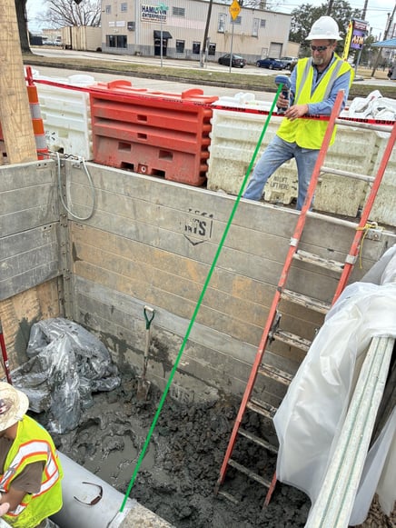
About 80% of an organization’s assets can be accurately mapped using traditional high-accuracy GNSS techniques—but what about the remaining 20%? If you have faced challenges collecting data in urban canyons, parking garages or heavy tree foliage, this webinar is for you.
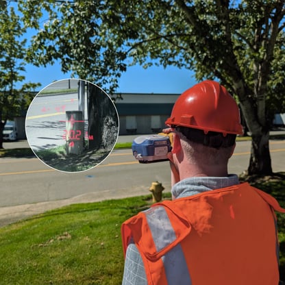
Join us for a free 90-minute webinar and virtual field demonstration of a new, patented mapping technology. You'll see how sensor fusion with GNSS, RTK, LiDAR, tilt, and other sensors are transforming workflows in popular apps (e.g., ArcGIS® Field Maps) and cutting-edge apps, like the new FastXY. By the end, you'll have a better understanding of how to enable field technicians to map at high accuracy in any environment.
In this webinar, you will learn:
-
How fusing sensors with GNSS is already transforming field mapping, and how to take advantage of this to map assets in GNSS-denied environments.
-
How to easily adopt sensor-fused GNSS technology into your existing workflows.
-
Best practices and methods for storing sensor metadata in your geospatial database
Special thank you to our partners:
.png?width=600&height=200&name=partners-logos%20(1).png)
Frequently asked questions
Is there a registration fee?
The webinar is offered at no cost to attendees.
How do I get into the webinar?
The registration link will be sent out a few days before the event. If you do not receive an email, please check your spam folder. Contact info@gps-mapping.com if you do not receive an email.
Will the webinar be recorded?
The webinar will be recorded and will be available at a later date.
Can you present this topic to my team?
Schedule an internal presentation on this or related topics.
Are any materials required to participate?
No additional materials are required to get the full benefit of the webinar.
How do I get the devices mentioned?
Visit our product page, or contact our sales team.